Chinese engineers make sci-fi drone mapping reality
By PENG CHAO in Chengdu |
chinadaily.com.cn |
Updated: 2025-03-13 16:41


Share


Share - WeChat


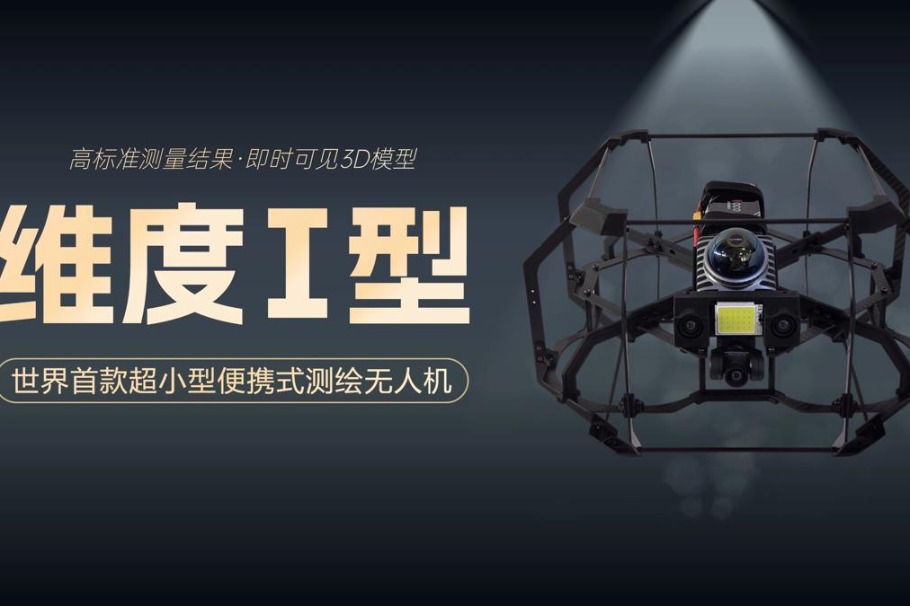
The drone features a spherical shell with a reinforced cage-like frame, allowing it to operate in high-risk environments such as municipal culverts and bridge-supported pipelines, the center said.
Equipped with the 3DAware? flight control system, the drone utilizes simultaneous localization and mapping technology to generate real-time 3D models of its surroundings, the center said. The Dimension I also carries a specially designed 4D-Aware software for video replay and 3D model inspection.


- Chinese engineers make sci-fi drone mapping reality
- Wild sables spotted in Changbai Mountain by dedicated photographers
- Study finds 'oasis of life' thrived in NW China during Earth's worst mass extinction
- Rare Chinese monkeys spotted scaling cliffs in Hubei
- Former senior political advisor Wu Yingjie to face corruption trial
- Octogenarian completes dual bachelor's degree programs through self-study