Chinese engineers make sci-fi drone mapping reality
By PENG CHAO in Chengdu |
chinadaily.com.cn |
Updated: 2025-03-13 16:41


Share


Share - WeChat


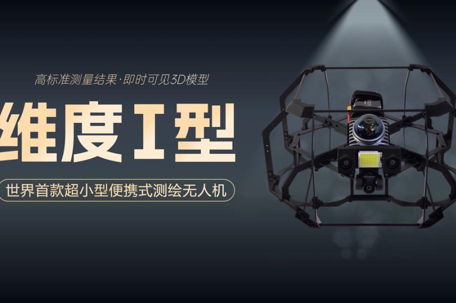
Zhang Dedong, the center's deputy director, said the drone maintains remarkable stability even in harsh environments, offering users a safer, more efficient and cost-effective inspection solution than traditional methods.
He said the operators require minimal specialized training to handle it and complete mapping tasks across diverse scenarios. Compared to traditional methods in similar environments, it reduces mapping costs by nearly half, according to the center.
The center is accelerating efforts to upgrade and commercialize the drone while continuously expanding its application scenarios, it said.


- Chinese scientists conduct detection experiment on Antarctic ice cap
- Chinese engineers make sci-fi drone mapping reality
- Wild sables spotted in Changbai Mountain by dedicated photographers
- Study finds 'oasis of life' thrived in NW China during Earth's worst mass extinction
- Rare Chinese monkeys spotted scaling cliffs in Hubei
- Former senior political advisor Wu Yingjie to face corruption trial